For free real time breaking news alerts sent straight to your inbox sign up to our breaking news emails
Sign up to our free breaking news emails
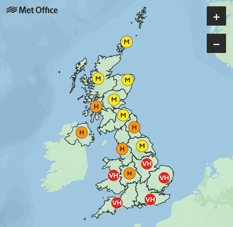
Hayfever sufferers are braced for a week of watery eyes and runny noses as the Met Office warned of very high levels of pollen across the UK.
The forecaster issued the pollen alert across much of England and Wales between Tuesday and Sunday, with Scotland getting away with high and medium levels of the substance until Thursday.
Pollen levels will remain very high across the south of England and Wales all week, with high levels moving north on Wednesday and Thursday.
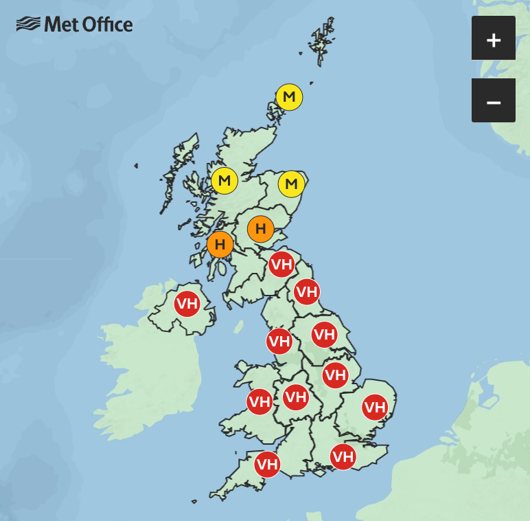
On Thursday, very high levels are expected in Northern Ireland, Wales, Dumfries and Galloway, the West Midlands, East Midlands, North West England, North East England, Yorkshire, the East of England, the South East and South West.
It comes as a short blast of summer heat was forecast for the UK this week after a long wait, with balmy temperatures of up to 25C.
June got off to a colder-than-average start but high pressure moving in from North America should cause a “shift” in the weather mid-week.
Met Office meteorologist Dan Harris said: “We are expecting to see a steady uptick through the second half of this week, rising to around or above average, and it will likely feel very warm for those in the sunshine.
“This initial spell of warm conditions isn’t expected to last too long however, as it turns more changeable through Friday and into the weekend with areas of cloud and rain spilling east across the UK.”
Temperatures are likely to peak at around 24C or 25C on Thursday and Friday in the south, with slightly cooler conditions in the North West, where there is a risk of clouds and showers.
Meanwhile, the first ten days of June were cooler than expected, with the mercury down an average of two degrees compared with normal temperatures for the time of year.
Dr Robert Thompson, a meteorologist from the University of Reading, said the biggest factor for cooler temperatures in June was the Atlantic jet stream, which is bringing in cold air from Greenland and Iceland.
He told The Independent that the lower-than-expected temperatures for the start of June were not entirely unusual and likely to revert back to normal in the second half of the week.