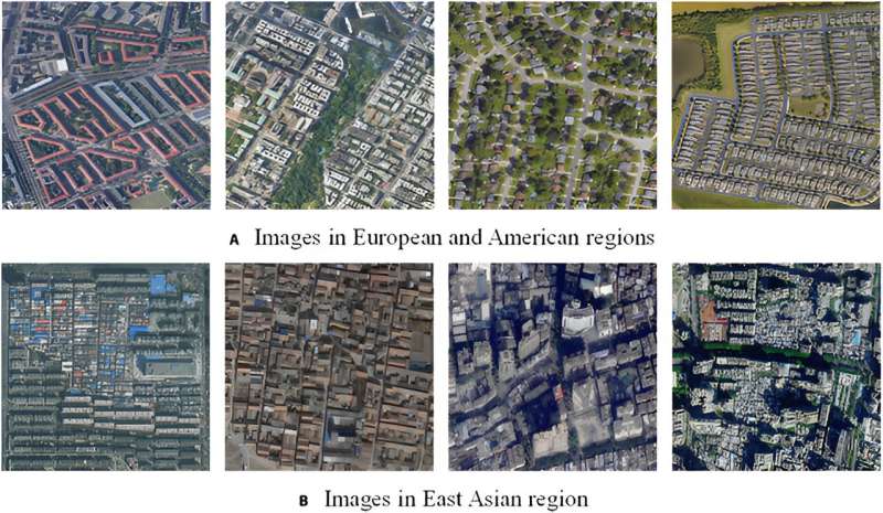
Accurate and comprehensive building data is critical for urban management and planning. Existing datasets, such as those from Microsoft and OpenStreetMap, often lack completeness and accuracy in East Asia, limiting their utility for large-scale applications. The complex distribution of buildings and scarcity of auxiliary data in this region further complicate the extraction of reliable building footprints.
Based on these challenges, there is a need for a more detailed and accurate dataset to support urban analysis and planning. Therefore, a comprehensive mapping framework was developed to address these issues and produce a high-quality building dataset for East Asia.
Researchers from Sun Yat-sen University, in collaboration with international experts, published their findings in the Journal of Remote Sensing, on 9 May, 2024. The study details a novel framework for building extraction using very high-resolution (VHR) images, marking a significant leap in urban data acquisition.
The study addresses the limitations of existing building datasets in East Asia by introducing a comprehensive large-scale building mapping (CLSM) framework. This framework employs innovative strategies such as region-based adaptive fine-tuning, stable boundary optimization, and high model efficiency through model distillation.
Using high-resolution Google Earth images, researchers extracted building footprints across five East Asian countries, resulting in a dataset of over 280 million buildings spanning 2,897 cities, with an average overall accuracy of 89.63% and an F1 score of 82.55%.
The CLSM framework effectively manages the complex layouts and diverse appearances typical of East Asian urban environments. Its boundary enhancement and regularization modules improve building boundary extraction accuracy, while the model distillation technique boosts computational efficiency. The region-based adaptive fine-tuning strategy enhances the model’s generalization capabilities, ensuring consistent high-quality results across various regions.
Compared to existing datasets, this new dataset offers superior quality and completeness, making it invaluable for urban planning, energy management, and related research fields.
Dr. Jiajun Zhu, a lead researcher in the study, stated, “Our comprehensive mapping framework addresses the critical need for accurate and complete building data in East Asia. This dataset not only enhances urban planning and management but also supports a wide range of research applications. The high accuracy and detailed representation of building footprints offer new opportunities for urban analysis and sustainable development.”
The implications of this research are far-reaching, offering support for urban analysis, energy modeling, and sustainable city planning. The dataset’s availability promises to be a cornerstone for future studies and urban development strategies in one of the world’s most populous and rapidly urbanizing regions.
More information:
Qian Shi et al, The Last Puzzle of Global Building Footprints—Mapping 280 Million Buildings in East Asia Based on VHR Images, Journal of Remote Sensing (2024). DOI: 10.34133/remotesensing.0138
Citation:
Unveiling East Asia’s urban landscape: A massive mapping project illuminates 280 million buildings (2024, July 3)
retrieved 3 July 2024
from https://phys.org/news/2024-07-unveiling-east-asia-urban-landscape.html
This document is subject to copyright. Apart from any fair dealing for the purpose of private study or research, no
part may be reproduced without the written permission. The content is provided for information purposes only.


